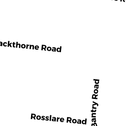
9 BANTRY RD
Owner Information
GOODMAN TARSHIS, ISABEL
9 BANTRY RD
FRAMINGHAM, MA 01702


Property Details
9 BANTRY RD is classified as a Single Family Residential (Ranch).
The primary structure on this property was built in 1957. There is 1,690ft2 of residential/living space within this property. This property is listed as having 8 rooms.
9 BANTRY RD is valued at $475,400. The land is valued at $195,500 and the structures are valued at $276,800. There is an additional valuation of $3,100 on this property.
This property is in Zone R-1. Confirm with local Zoning Board authorities to ensure there are no overlays or other easements on this property.
The most recent deed for 9 BANTRY RD is recorded at the local registrar in Book 78091, Page 551. 9 BANTRY RD was last sold on Thursday, June 24, 2021 for $581,000.
Assessment data from fiscal year 2022.
Flood Data
According to the FEMA National Flood Hazard Layer, this property does not appear to be in a flood zone. It may also be in an area not yet reviewed. Nonetheless, confirm this information prior to taking any action.
To view the flood hazards around this property, create a FEMA "Firmette" Map of the area around 9 BANTRY RD.
Broadband Internet Providers
| Provider | Type | Bandwidth (mbps) | |
|---|---|---|---|
| RCN | Cable | 1000 | 20 |
| Verizon New England Inc. | Fiber | 940 | 880 |
| Viasat Inc | Satellite | 100 | 3 |
| Comcast | Cable | 1000 | 35 |
| VSAT Systems, LLC. | Satellite | 2 | 1 |
| HughesNet | Satellite | 25 | 3 |
| GCI Communication Corp. | Satellite | 0 | 0 |
| RCN | Cable | 500 | 20 |
Broadband service provider data from December 2020.
Adjacent Properties
- 6 PITT RD
Single Family Residential owned by ROMINE, KRISTIN J TR - 7 BANTRY RD
Single Family Residential owned by GHAZARIAN, JAKLIN - 10 PITT RD
Single Family Residential owned by HUBER, WILLIAM P & ERIN M - 12 PITT RD
Single Family Residential owned by ZENG, PING - 4 ROSSLARE RD
Single Family Residential owned by DIAZ, FREDDY - 6 ROSSLARE RD
Single Family Residential owned by RODRIGUEZ, FERNANDO LUIS & NICOLE TEITJEN - 11 BANTRY RD
Two-Family Residential owned by MAHAMAD, AMINA & AHMED, SOUNIA